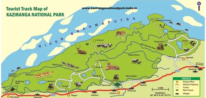
Kaziranga National Park Tourists Map
Kaziranga National Park detailed tourist map help you in understanding the total geographical stretch of the park here. This map will take you on the virtual tour of the park. It helps in making better understanding of the park before you head towards jeep or elephant safari inside the core area of the jungle. The map depicts everything starting from the entry gate to designated safari routes of the park.
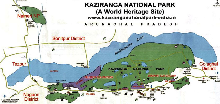
As we know that Kaziranga National Park is sprawl over a big span of area and it is impossible to explore in a day or two. So in order to provide better tourism experience its area is segregated in to four tourism zones. You can take the help of Kaziranga Tourism Map and sail through the core or buffer area of the park. You can plan accordingly and decide which tourism zone to be explored first. Kaziranga National Park (KNP) (26°35'–26°45’N and 93°05'–93°40’E)is located in the floodplain of the Brahmaputra river in the Nagaon, Golaghat and Sonitpur districts of Assam, India, covering an area of 1030 km² and is the largest protected area on the southern bank of the Brahmaputra River.